Centre for Metropolitan History Datasets
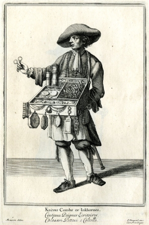
 'Knives combs or inkhornes', from the 'Cries of London'
(1688). © Trustees of the British Museum.
Introduction
The Centre for Metropolitan History (CMH), established in 1988 and based at the University of London's Institute of Historical Research, is one of the world’s leading centres for the study of the history of London and other metropolises. It specialises in innovative research projects, covering a wide range of periods, themes and problems in metropolitan history, publishing the results and data online and in print. A number of the datasets used in Locating London's Past have been drawn from CMH projects that have been undertaken over the last twenty years.
The London and Middlesex Hearth Taxes
The first dataset to be included was created by the London and Middlesex Hearth Tax (1666): an analysis of the status and wealth of neighbourhoods and households on the eve of the Great Fire project, a collaboration between the CMH and the Centre for Hearth Tax Research at the University of Roehampton. See London and Middlesex Hearth Tax (1666).
This project digitised the hearth tax returns for metropolitan London in the late 1660s, providing records of householders in every parish. The hearth tax was essentially a tax on wealth, and householders were liable to a set schedule of taxation depending upon the number of hearths (and ovens) in their house, with larger numbers of hearths equating to larger houses (and therefore in theory to wealthier households). In raising the tax a comprehensive set of listings were drawn up across the whole country, which were periodically updated. Many of these listings survive in The National Archives and they provide an important insight into distributions of wealth and population density across the country.
![Bird's-eye plan of the west central district of London, by Wenceslas Hollar (1660-66)]]. © Trustees of the British Museum. Bird's-eye plan of the west central district of London, by Wenceslas Hollar (1660-66)]]. © Trustees of the British Museum.](images/covent_garden.jpg) Bird's-eye plan of the west central district of London, by
Wenceslas Hollar (1660-66). © Trustees of the British Museum.
Bird's-eye plan of the west central district of London, by
Wenceslas Hollar (1660-66). © Trustees of the British Museum.
The data comprise the surviving returns for metropolitan London for Lady Day (25th March) 1666, supplemented where there are gaps in the geographical coverage by selected returns from earlier listings in 1662/3 and 1664. The 1666 listings are particularly useful in that they not only record the names of householders, but they also often give their occupations. In addition to information about householders and the size of their houses, the returns also provide details of uninhabited or empty houses, and those houses which were inhabited by individuals who were too poor to pay the tax. In many areas of London, particularly in the poorer suburbs to the east of the City, there were very significant numbers of the poorer households listed in the returns.
In terms of the geographical information in the hearth tax returns, each record is identified with a parish or ward. The majority of the returns relate to parishes, however. The gaps in coverage have been filled, where possible, from those ward-based returns from 1662 where the precinct (sub-unit of the ward) can be matched to a parish. In some cases this has not been possible, and so there are some gaps in the parish coverage, such as St Michael Cornhill and St Martin in the Vintry. It should also be noted that returns grouped under parishes sometimes included areas that were later counted as separate units, such as the Precinct of Bridewell, which was included under St Bride's parish. Street-level information was not always recorded in the returns, but where it has been it is possible to reconstruct the relative positions of householders along their street topographically, although usually this provides for indicative rather than accurate mapping.
Data from the Hearth Tax returns can be searched and mapped in a number of ways. On the data form, the results can be restricted to either male or female householders, or those for whom the gender is unknown. The number of hearths per household can also be limited within the range 0 to 193, for example in order to exclude very large residences, such as that of William, Earl of Craven, in St Clement Danes parish (120 hearths). The parish can also specified, although this can also be done on the results page using the standardised list.
The results of all searches are grouped initially by parish because most the 1666 returns are arranged in this way. Gaps in coverage are filled where 1662 data can be matched to particular parishes, as described above. The parish results are adjusted by default to show the average number of hearths per household, but this can be altered to show the total number of hearths in each parish. The results can also be adjusted to reflect the size or overall population of the parish. It is also possible to group by gender (to see the breakdown of male/female/unknown), and occupation, although these cannot be mapped. Displaying the results breakdown on the map provides a parish-by-parish analysis of the hearth tax returns, according to the filters applied earlier on the data and results pages. Searching across the range of hearths, for example, shows that St. Paul’s Covent Garden had an average of just over 9 hearths per household and is represented by the heaviest shading. As with all the maps, particular parishes can be disregarded, and the mode of display can be changed to show pins or blocks. In this way it is possible to compare areas London, such as the City and suburbs, as well as neighbouring parishes.
Mortality and Plague, 1665
This dataset presents a small proportion of the material gathered by the project Epidemics and mortality in the pre-industrial city: Florence and London compared undertaken at the CMH in the late 1980s. This project was a study to compare the effect of epidemic disease on two of the major cities of seventeenth-century Europe, using the outbreaks of 1630-3 in Florence and those of 1665 in London as case studies. Non-epidemic patterns of mortality in the two cities were compared with those for the crisis years, paying special attention to the geographical spread of plague within the cities and its differential impact in areas of contrasting social and physical character.
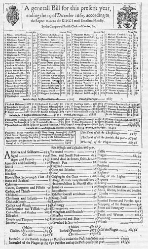
The data comprise a collection of aggregated statistics concerned with the numbers of burials in London during the year 1665, and specifically the number of burials of plague victims. Weekly totals of plague burials taking place in almost all of London's parishes in both cases are given, having been calculated from the Bills of Mortality (for more information on the Bills see Estimating London's Population).
On the Data page, searches can be limited to a particular week or range of weeks in 1665 using the drop-down menus. So, for example, selecting the range 30 to 46 produces results that cover the period when plague was at its height in London, with burials in All Hallows Barking rising to a peak of 41 in week 40 (September). The search options also enable the parish itself to be specified, or this can also be done on the results page.
Running a search then produces results (numbers of burials) that are automatically grouped by parish, reflecting the way in which the burial data was collected. At this point, a particular parish can be selected from the list of results on the left. The results can also be adjusted to reflect the physical size of the parish, and the population (for which see Estimating London's Population), especially important for studies of mortality. Clicking ‘Display breakdown on map’ therefore produces a map of burials in London, by parish, based on the criteria specified on the data and results pages. The display mode can be changed to show pins or blocks of different kinds, revealing clusters of high mortality across the city at different points in 1665.
Bibliography
- The London and Middlesex Hearth Tax returns are available from British History Online in an edited format, or in their entirety from the University of London's e-Repository SAS-Space.
- K. Schurer and T. Arkell eds. Surveying the people: the interpretation and use of document sources for the study of population in the later seventeenth century (Local Population Studies 1992)
- J. Champion (ed.), Epidemic disease in London (Centre for Metropolitan History, Working Papers Series, No. 1, 1993), available online.
- J. Champion, London's dreaded visitation: the social geography of the Great Plague in 1665 (Historical Geography Research Series, no. 31, 1995)

