Ordnance Survey, 1st edition map of London 1863-80 (1:2500)
Introduction
In order to create a geo-referenced and rectified version of John Rocque’s map of 1746 it was essential to select an accurate modern base map. The purpose of the base map was, on the one hand, to allow the project team at MOLA to ‘warp’ Rocque to fit on to a modern framework, and at the same time to provide key data relating to the city’s street pattern, parishes, wards and other boundaries which could be overlaid on the earlier map. Rocque’s role here was to act as a guide as to which streets, for instance, needed to be mapped. At the same time the project needed a map which was as early as possible in date, to avoid having to take account of, for instance, the expansion of the above and below-ground railway network and stations, changes enforced by bombing in World War II, as well as other changes to the capital’s streetscape. Inevitably, of course, many aspects of the city had nonetheless changed significantly, presenting challenges to the geomatics team. An example is the construction of Holborn Viaduct: here, and despite its own surveying deficiencies, Rocque’s map was itself a valuable source for the appearance of the area before the Viaduct’s construction in the 1860s.
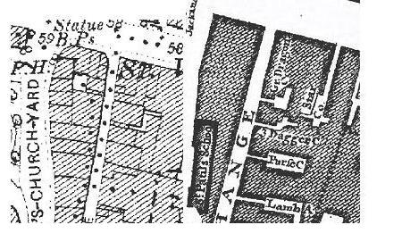
 Comparison of the area around north Cheapside on 1st edition
O.S. and Rocque maps. On the former the parish boundary is
visible as a dotted line, and the alleys and property boundaries
clearly delineated.
The Ordnance Survey and London
England’s first national mapping agency – the Ordnance Survey – was founded in 1791, almost 50 years after the creation of Rocque’s central London map. The first notable act of the OS was to carefully measure a baseline in Hounslow, west London, so that it could form the first part of a control network of survey points that would eventually cover the nation, and be the bedrock of every single map the O.S. produced of the British Isles until the advent of global positioning systems. Early county maps that included their respective parts of London were produced in the first two decades of the nineteenth century, and these informed many of the independent maps of the city that were produced over the next fifty years. Eventually, between 1848 and 1850 a five-foot map (1:1056) was compiled for London at the instigation of the Metropolitan Sanitary Commissioners, urged on by Edwin Chadwick and other health campaigners. Few complete copies of this survive. However, it was accompanied by a reduced twelve-inch scale map in 847 sheets, known as the ‘Skeleton Plan’ because of its relative lack of detail.
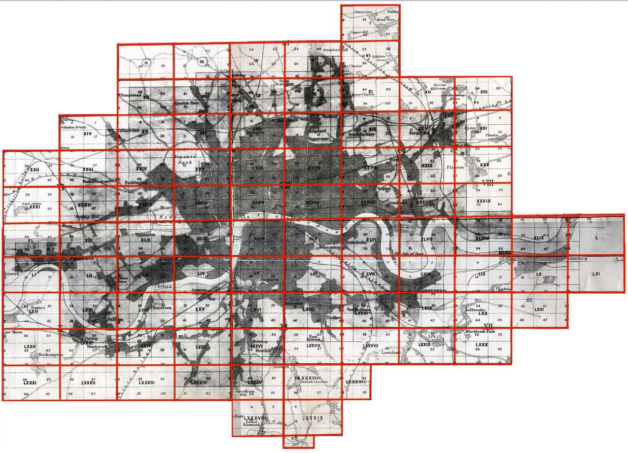
The map selected for the Locating London’s Past project was created in the wake of the decision of the Treasury in 1863 to extend the existing O.S. scheme of twenty-five inch mapping (1:2500) into southern England. This series is known as the 'County Series', and is normally categorised by 'Epoch', with Epoch 1 generally referring to the first county series published between 1846 and 1901, and Epoch 2 denoting to the first revision published between 1888 and 1915. Sheets for particular regions and cities, such as London, were of course produced at particular points within these periods. For London, however, the map was published initially in a five foot edition (1:1056) which was made up of 326 sheets and finished in 1876, and then from 1871-80 at the 1:2500 scale in 90 sheets – the version used here. As with the other counties, the sheets for London form their own separately numbered series. They conform to the dimensions specified for the county series, at 38 x 25.344 inches (96.6 x 64.4 cm). The full extent of the coverage of the 90 London sheets can be seen at http://www.bl.uk/images/maps/maps_lon_25in1st.jpg.
For the purposes of the project, only those sheets which covered the area represented by Rocque’s map have been used. The resulting map is based principally on the Epoch 2 revision, with gaps covered using information from Epoch 1 and, where needed, Epoch 3 (1900-49). The maps were supplied by Landmark Information Group Ltd, which has an agreement with the Ordnance Survey to make its digital archive available. The 1:2500 base map has been employed by a number of other digital mapping projects over the past ten or fifteen years, including the Charles Booth Online Archive. It is generally accepted as providing the earliest reliable mapping of the metropolis, sufficiently detailed, accurate and at a large enough scale to be used effectively by historians and historical geographers and within projects, such as this, which involve generating polygon data for use with earlier maps. Critically, the O.S. maps contain important information concerning boundaries (properties, parishes, wards etc), reliable data on street dimensions, as well as a host of incidental details such as field names, the names of churches and other buildings, and locations of warehouses and other industrial premises.
Further reading
- J.L. Howgego, Printed Maps of London circa 1553-1850, 2nd edn. (Folkestone, 1978).
- R.N. Hyde, Printed Maps of Victorian London (Folkestone, 1975).
- Richard R. Oliver, Ordnance Survey Maps: a concise guide for historians, 2nd revised & enlarged edn. (London, 2005).
- Ordnance Survey.


